Best Scenic Drives Around Murrieta: Views, Fall Color, and Golden Hour
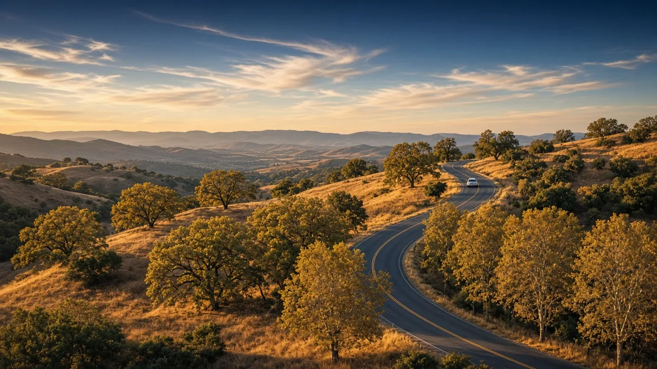
Murrieta sits in a valley ringed by golden foothills, and one of the best ways to understand why people love this corner of Southwest Riverside County is to drive it. From the classic climb up Clinton Keith Road to Tenaja Road and the broad plateaus of the Santa Rosa Plateau to the vineyard rows of Temecula's wine country, the roads around town deliver some of the most beautiful views in the region. Laura Holbert and Cheryl Shadden of Team Integrity Realty have driven these routes for years while showing homes to buyers, and this guide gathers the scenic loops and viewpoints they share with new neighbors and visitors.
Why a Drive Is the Best Way to See Murrieta's Setting
Murrieta's geography is its quiet superpower. The city spreads across the floor of a wide valley with the Santa Ana Mountains rising to the west, the Palomar range to the south, and miles of oak-dotted ranchland in between. From any of the foothill roads you get a postcard of Southern California living: warm stucco homes with terracotta roofs, golf-course green, and ridgelines that turn cobalt and rose at dusk. The seasons make the drives even better: late October into November brings gold and amber to the willow, sycamore, and cottonwood trees along the creek corridors, and winter brings clear air and extra-crisp views. Our guide to Murrieta's weather and seasons explains why the light here is so good; the short version is to aim for the two hours around sunset.
Route 1: Clinton Keith Road to Tenaja Road, the Classic Foothill Climb
The drive every local recommends starts at the I-15 Clinton Keith Road exit (Exit 68), just north of Murrieta. Head west and within a couple of miles the road curves uphill, the suburban strip giving way to chaparral and live oaks, and you will notice it has quietly become Tenaja Road. The climb rewards you fast: turn around at one of the wide dirt pullouts and you look back across the whole valley, with the Murrieta and Temecula city lights blinking on below as evening sets in. The route passes the entrance to the Bear Creek neighborhood, one of the foothill communities that make this part of town so desirable, then continues toward the ranch country around Tenaja and La Cresta, which our neighborhood guides cover in detail.
Route 2: The Santa Rosa Plateau, a 9,000-Acre Overlook
Follow Clinton Keith and Tenaja Road far enough west and you reach the Santa Rosa Plateau Ecological Reserve at 39400 Clinton Keith Road. This roughly 9,000-acre preserve of Engelmann oak woodlands, vernal pools, and rolling grassland is the crown jewel of the area's open space, and it can be enjoyed without ever leaving the car. The road into the reserve passes parking and pullouts at the Visitor Center, Hidden Valley, Sylvan Meadows, and the Vernal Pool trailheads, each one framing a sweeping view of the plateau and the valley far below. In November the oak and sycamore groves go gold, and on clear winter evenings the sunset turns the whole grassland the color of warm honey. To see it on foot instead of from the driver's seat, start with our hiking guide and the city trail network. Serious birders can also pair the drive with our birdwatching guide.
Route 3: Tenaja Road Into the National Forest, for the Adventurous
If you want the drive to feel like an escape, keep going. Beyond the reserve, Tenaja Road narrows and climbs another stretch toward the Cleveland National Forest, and about a mile up the gravel Cleveland Forest Road (7S01) you can park at the Tenaja Falls trailhead in the San Mateo Canyon Wilderness. This is a true backcountry road: parts are unpaved, cell service drops away, and you will pass more cattle gates and hawks than cars. Go with a full tank and plenty of daylight. The payoff is a creekside waterfall hike in one of the most peaceful corners of the county. Our camping and mountain guide has more on the wilder side of living near Murrieta.
Route 4: The Wine Country Loop
Head south instead of west and you find a different kind of scenery. Take I-15 south to Temecula, then follow Rancho California Road west through the rolling vineyards of the Temecula Valley. The loop delivers wide-open views of vine rows climbing the hillsides, and the wineries themselves are built for exactly this: tasting-room patios with valley panoramas, picnic grounds, and, in the fall, harvest activity in the vineyards. It is the area's most famous drive for good reason, and our wine country day trip guide maps out wineries worth stopping at. For the full valley panorama, keep pushing Rancho California Road toward De Luz, where the road rises above the vineyards and the lights of the whole valley spread out behind you at night.
Route 5: Pala Road to Palomar Mountain, the Big Detour
When you have a free afternoon, point the car down Pala Temecula Road and head southeast toward the Palomar range. It is about a 30- to 40-minute drive to the foot of the mountain, and from there the graded switchbacks climb through oak and pine forest to Palomar's cool summit. On the way up, the valley you left behind unfolds in every direction, and on clear days you can pick out the ocean smudge on the horizon. It is a favorite escape on hot summer days and a spectacular golden-hour route in fall. If you are still building your list of nearby getaways, our day trips guide covers more of them.
In-Town Viewpoints: Sykes Ranch Park and Old Town
You do not have to leave the city limits for a good view. Sykes Ranch Park, one of Murrieta's hilltop neighborhood parks, offers wide views over the valley with benches, grass, and a playground, which makes it an easy sunset stop with kids. And no scenic drive is complete without a slow loop through Old Town Murrieta, where the historic storefronts along Washington Avenue glow warmly against the foothills. Both are free and easy sunset stops.
Golden-Hour Tips for a Great Drive
A few habits make these drives better. Aim to be on the road 45 to 60 minutes before sunset so you catch the color deepening, and use the wide dirt pullouts for photos instead of stopping in the driving lane. Fill the tank before you head out; fuel is scarce past the reserve. Bring water, a light jacket, and a snack if you plan to picnic at a lookout. Watch for cyclists, horses, and wildlife on the two-lane roads, especially around corners, and on the gravel sections of Tenaja Road, go slow and let faster traffic pass at the turnouts. If you would rather walk your views than drive them, the trails page and our parks guide have those covered too.
Make an Afternoon of It
The best part of these drives is that they all pair naturally with a meal or a stop in town. End the Clinton Keith climb with dinner in Old Town Murrieta, turn the wine country loop into a date using our date night guide, or build a full day for the family with our family weekend guide and the things to do page. For a running calendar of what is happening around town, keep an eye on the community events calendar. However you build it, a golden-hour drive is the fastest way to fall for this valley, and it is one more reason people who visit Murrieta never really leave.
Ready to Make These Views Your Everyday?
Many of the people Laura Holbert and Cheryl Shadden of Team Integrity Realty work with first fell in love with Murrieta from the driver's seat: a golden-hour climb, a vineyard view, a sunset at a hilltop park, and suddenly the relocation conversation starts. If that sounds like you, they would love to show you the neighborhoods and homes near your favorite routes. No pressure, just honest local guidance.
Laura Holbert · Broker, CA DRE #01932682
Cheryl Shadden · CA DRE #01935462
Team Integrity Realty · 37290 Los Alamos Rd. Murrieta, CA 92563